Key Figures

Ferdinand Vandeveer Hayden

The settlement of the Great Plains would never have happened so quickly, if not for a few key figures. Among them was Ferdinand Hayden, a theologist and surgeon by training, but a naturalist and geologist at heart.

Hayden was born in Massachusetts, but a troubled childhood—an alcoholic father and an abandoning mother who were unmarried—led him to be raised by his aunt and uncle in Ohio. Eventually, he made it to Oberlin College and attained a degree in theological studies, and later to Albany Medical College, where he received his medical degree. In Albany, however, he also met a number of aspiring paleontologists, such as James Hall and F. B. Meek. These two encouraged him to reach out to others, and to go out west and explore. At this time, his field work was focused around South Dakota and the Missouri River.

Hayden began publishing geologic papers with Meek, as well as collecting vast collection of fossil and archaeological specimens. Together, he and Meek are credited with some big finds: the first soft-shelled turtle fossil in America, and the first dinosaur remains. That’s not all. Hayden also gathered fish, shells, plants, mammoth and mastodon teeth, mammal bones, and more. On the human side, he found axes, pottery, flint shards, and mining tools. The Smithsonian Institute was quite intrigued with these artifacts, and unofficially recruited him to help them expand their own collection. Hayden became part of the Megatherium Club with a few other gentleman scientists and collected thousands of specimens for the Smithsonian.

After a few years as a surgeon for the Union army during the Civil War, Hayden went back to his geology. He headed a party that discovered and surveyed the vast coal beds of Colorado and Wyoming, making news all the way across the pond in London. Hayden then went on to survey Iowa and Nebraska, Montana, Missouri, New Mexico, and Wyoming. His reputation as a geologist grew so much that his funding from the government grew from $5,000 to $75,000 a year. Hayden was even considered for the first director of the newly formed U.S. Geological Survey—though he didn’t get the job.

While not an active proponent of rain follows the plow, Hayden’s exploration did lead him to believe that the planting of trees in the Great Plains would be the key in the settlement and agricultural prosperity of the region. He had seen how the addition of trees might have increased rainfall in other regions and was ready to extend that idea to his beloved Great American Desert.

Featured photo courtesy of Thomas on Pexels stock photos:

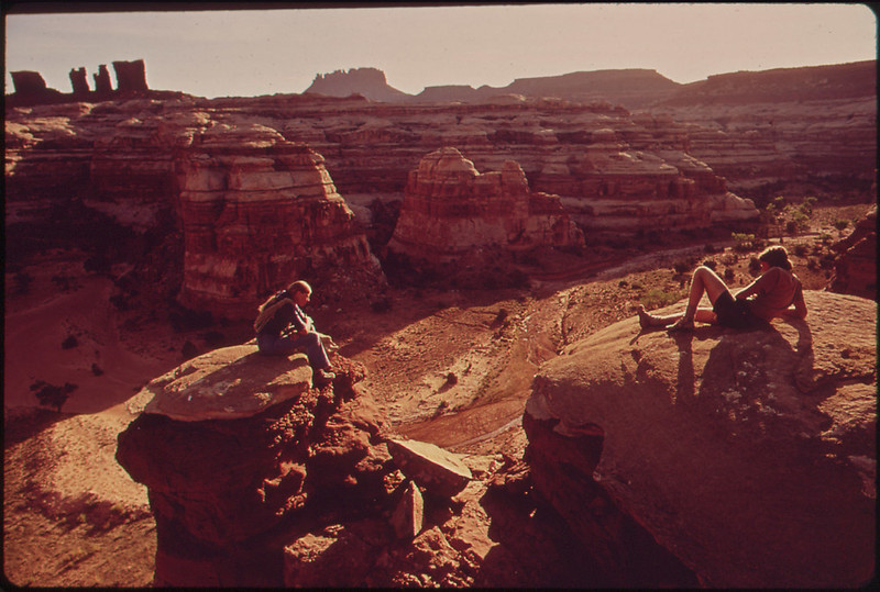
https://www.pexels.com/photo/south-dakota-badlands-53817/

See the following sources for more info:

https://www.si.edu/sisearch/collection-images?edan_q=ferdinand%2Bhayden

https://siarchives.si.edu/featured-topics/megatherium/introduction

Foster, M. (1986). Ferdinand Vandeveer Hayden as Naturalist. American Zoologist, 26(2), 343-349.

M. B. (1888). FERDINAND VANDERVEER HAYDEN. Scientific American (1845-1908), Lviii.(No. 1.), 9.

Picard, M. (2010). Revisiting the life and scientific reputation of Ferdinand Vandeveer Hayden. Rocky Mountain Geology, 45(1), 75-81.

Current Earth Science

Humans, the Short End of the Time Scale

The long-winded history of the Great Plains is recorded in the geological features we see today. The Precambrian shows itself in outcrops of the pink Town Mountain granite, the Packsaddle schist and Valley Springs gneiss. These rocks tell a story of massive chambers of boiling-hot magma being pushed to the surface to cool, and surrounding rocks being metamorphosed by intense heat and pressure. In the Paleozoic and later in the Cretaceous, ancient shallow seas covered the inner continent and produced carbon-rich rocks. Limestones, shales, and fossilized reefs are scattered throughout the Great Plains and nearby areas, evidence that the area was not always the ‘Great American Desert’. Decaying plant matter built up and compressed over time resulted in coveted coal deposits. When the waters retreated, the temperatures started going down, too.

Now, the Great Plains are dusted by a layer of younger sediments—sand and gravel and soil—eroded from the Rocky Mountains on the western border. These sediments help trap water underground in aquifers, supplying the region and its inhabitants. It is no surprise that pockets of water have been attracting all sorts of living beings for thousands of years, and early humans were no exception.

The common consensus among archaeologists is that humans began living on the Great Plains at least 11,000-11,500 years ago, based on carbon dating of various artifacts like bones, stone flakes and tools. This time overlaps with the last Ice Age, and the time of giant creatures like mammoths and saber-tooth cats (see Miocene and Mammoths). In 2005, a study took advantage of some broken mammoth bones that had been on display at the Denver Museum of Nature and Science for nearly 30 years. The bones appeared to have been broken by humans rather than by natural means, and were carbon dated at about 12,200 years old. Many scientists are drawn to the significance of discovering the oldest site with clear evidence of human habitation, and so research continues.

Humans have been fascinated by the challenges and opportunities offered by life on the Great Plains for a very long time, whether because of water and food resources, the hunt for gold and precious materials, agriculture, or an adventure. This curiosity is prominently realized in the mid-1800s, when Americans were surveying the Territories and some people thought that rain would follow the plow.


Featured photo courtesy of U.S. National Archive:

Hikers Terry Mcgaw and Glen Denny Enjoy a View of the Maze from the Top of a Ridge Separating Two Canyons. The Maze, a Wild and Rugged Region in the Heart of the Canyonlands, Has No Footpaths, and Hikers Enter by Means of Ropes Or Steps Cut in the Rocks,


See the following sources for more info:

http://geology.teacherfriendlyguide.org/index.php/rocks-sc/rocks-region4-sc

https://www.geosociety.org/documents/gsa/timescale/timescl.pdf

Denver Post Staff Writer. “Museum’s Mammoth Bones Exhibit New Life After Nearly 30 Years on Display, Fossils Found in Kansas Are Causing Scientists to Re-examine When Humans Arrived on the Great Plains. (DENVER AND WEST).” The Denver Post (Denver, CO), 2005.

Curious Blurbs

Clean Burning Coal

When studying coal formation, origins usually point to the Carboniferous period in geologic history, 359-299 million years ago. Shallow inland seas, like the Western Interior Seaway discussed in the last post, were intermixed with thick trees and plant life, creating the perfect swampy wetlands where coal is formed. Decaying plant matter, buried and squeezed by mud, retains a lot of carbon. Over millions of years, the layers of dead plants undergo a process of pressure called carbonization.

The deeper the burial, the better the coal; higher carbon concentrations in the rock burn better and cleaner. Carbonization creates four main types of coal, from lowest to highest grade: lignite, sub-bituminous, bituminous, and anthracite.

Coal is formed on all continents, and the U.S. is among the biggest sources. While most U.S. coal comes from the East Coast, most famously from Pennsylvania and the Appalachian Region, a significant amount comes from the ‘Western Coal Region’, essentially the Great Plains. Coal from the western United States tends to be Cretaceous in age (see the post The Cretaceous Interior Seaway), corresponding with the dinosaurs, and more importantly the Western Interior Seaway, which provided the wet environment and flourishing plant life needed to form coal.

“Coal is the largest source of energy for generating electricity in the world, and the most abundant fossil fuel in the United States.”

Nine major coal-producing regions exist within the Great Plains, including some resources in Canada, and Wyoming is by far the top producer. The majority of these locations produce low-grade coal, of the lignite and sub-bituminous types. These sources supplied early explorers, farmers, and railroads, but after World War II, mining and production of coal took a nose dive. The need for energy did not decrease. In fact, it exploded, and desire for fuel has only increased since the 60s. The government also began setting stricter emissions standards at this time, and as a result, many hopeful surveyors set out to find their fortune in clean-burning coal.


Featured image courtesy of U.S. National Archive:

Utah  -  Near Moab, 05/1972


See the following sources for more info:

http://plainshumanities.unl.edu/encyclopedia/doc/egp.ind.014

https://www.nationalgeographic.org/encyclopedia/coal/

https://www.geosociety.org/documents/gsa/timescale/timescl.pdf

Roberts, Laura N. Robinson, Laura N. Robinson. Kirschbaum, Kirschbaum, Mark A., and Geological Survey, Issuing Body. Paleogeography of the Late Cretaceous of the Western Interior of Middle North America: Coal Distribution and Sediment Accumulation. U.S. Geological Survey Professional Paper; 1561. Washington: Denver, CO: U.S. G.P.O.; U.S. Geological Survey, Information Services, 1995.

Deep Time Snapshot

The Cretaceous Interior Seaway

Jurassic Park helped to give dinosaurs their fame, but this really wasn’t when dinosaurs ruled the Earth. The Cretaceous period, starting about 145 million years ago, was the real heyday of our giant mesothermic friends (most dinosaurs were not ectothermic, or cold-blooded!). Until their extinction around 66 million years ago, dinosaurs were spread across the globe, including in the Great Plains region. At this point, Pangea had broken apart and North America was starting to look like the massive continent we know today.

Even more interesting, the North American landmass was home to a Cretaceous inland sea. The Western Interior Seaway was a result of incredibly high sea level, where a shallow ocean covered a massive part of the continent. “At its maximum extent, the seaway extended for 4,800 km from the North Slope of Alaska to northern Mexico and was approximately 1,620 km wide from central Utah to Minnesota,” according to a U.S. Geological Survey report. This includes much of the Great Plains region.

Evidence of this inland sea lies in the paleontology—the fossils—of the region. Geologists have found an incredibly diverse variety of marine fossils all over the landlocked states, even here in Arizona. The fossils found are not just shallow water creatures, though some extensive coral reef remains have been studied. Giant turtles, ammonites, crinoids, sharks and fishes have been discovered in areas that are now deserts and grasslands. On top of that, giant marine beasts resembling the Loch Ness monster, like Mosasaurs and Plesiosaurs who needed large expanses of salty ocean water to survive, have been found. Right along side these are the bones and tracks of dinosaurs who tromped on the muddy shores.

The rock that hosts the marine fossils also tells the tale of deep ocean covering North America. Chalk, limestone and dolostone are carbonate rocks, created when microscopic sea-critters died and accumulated on the ocean floor, eventually compacting into solid rocks.

By the end of the Cretaceous, the Rocky Mountains were beginning to form, and the Western Interior Seaway was retreating. The dropping sea level and receding inland sea led way to swampy environments, and later, the formation of coal.


Featured photo courtesy of U.S. National Archives:

Aerial View Upstream of Boom Site in Monument Valley, Utah Where Oil Spill Into the San Juan River Was Contained before Flooding Caused Overflow of Oil and Debris Into Lake Powell, 10/1972


See the following sources for more info:

http://geology.teacherfriendlyguide.org/index.php/fossils-sc/fossils-region4-sc

https://www.geosociety.org/documents/gsa/timescale/timescl.pdf

Roberts, Laura N. Robinson, Laura N. Robinson. Kirschbaum, Kirschbaum, Mark A., and Geological Survey, Issuing Body. Paleogeography of the Late Cretaceous of the Western Interior of Middle North America: Coal Distribution and Sediment Accumulation. U.S. Geological Survey Professional Paper; 1561. Washington: Denver, CO: U.S. G.P.O.; U.S. Geological Survey, Information Services, 1995.